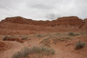
Utah is known for its five national parks- Arches, Bryce Canyon, Canyonlands, Capitol Reef, and Zion. Many summer driving trips include stops in these national treasures. While these Utah parks are spectacular and well maintained, visitors to this area should not forget to check out state run facilities. During our latest trip to Utah, we were pleasantly surprised whenever we explored a state park. Today, I will share what we saw at Goblin Valley State Park.
Goblin Valley State Park is located in Emery County Utah, approximately 50 miles southwest of Green River off State Highway 24 and 20 miles north of the town of Hanksville. The distance from Moab to Goblin Valley State Park is approximately 100 miles while the distance from Goblin Valley State Park to Capitol Reef is approximately 70 miles.
This part of Utah is desolate. I highly recommend leaving Moab or Capitol Reef with a full tank of gas, a gallon of water per person, and sufficient food for the day trip.
Be prepared for sudden changes in the weather. In the spring and fall, the area can be pelted with strong winds, rain, hail, and snow. Afternoon thundershowers with lightning are common in the summer. When we arrived, the winds were treacherous. Sunglasses or eyeglasses were essential. A bandana would have been helpful to cover my nose and mouth. I had sand, dirt, and grit in my mouth and teeth for a day or two afterwards. I couldn’t wait to return to our hotel room to wash out the dirt that was embedded in my scalp and clinging to my hair.
Why did we choose this off the beaten track Utah State Park?
A handful of people online had raved about this place. They claimed it was a must see. Was this possible? Looking at the map, we could clearly see that the state park was off by itself. We were up for the adventure.
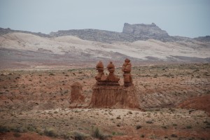
After leaving the entrance/visitor center, we continued along a paved road. In the distance, we were mesmerized by the stone sculptures that resembled mushroom shaped goblins. These unique rock formations made us stare with amazement as our mouths dropped open. Some of these landforms were in small groupings.
Near the trailhead, we read a sign that identified the landforms in the horizon as the San Rafael Reef. Early settlers used the word “reef” as an analogy. They were comparing the challenges of coping with oceanic reefs to the difficulties of traversing through this area that comprises 2000+ square miles of rock towers, arches, deep canyons, and panoramic scenery.
The San Rafael Swell rises above the desert in a dome like formation. Scientists estimate that this happened approximately 60 million years ago when nature caused the horizontal rock layers to arch in an upward fashion. The older rock layers have been exposed to the forces of erosion in the center of the swell while the newer layers are exposed at the edges.
Goblin Valley was a bit different. What caused the land in this area to be magically transformed into the curious and unique shapes that resembled goblins?
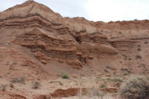
Goblin Valley State Park
I bought a pamphlet at the visitor’s center that provided a detailed and complex scientific explanation.I had to read it over several times before I had an inkling of the content. It’s impossible to adequately summarize the complete process in just a few sentences. In a nutshell, Goblin Valley was the result of millions of years of geological history. It’s hard to imagine that this part of Utah was once near an ancient sea. During the Jurassic Period (145-170 million years ago), the sandstone layer was weakened and weathered more quickly. Millions of years of erosion changed the shape of the land. The end result was the mystical looking formations that delight everyone who ventures to this out-of the-way location.
I need to rephrase that comment. Not every visitor respects nature. This park became the focus of international news reports when two former boy scouts intentionally toppled one of these structures and destroyed it in the process. Months later, the individuals were charged with felonies.
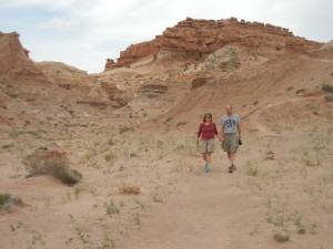
Despite the weather, we had an amazing time exploring this secluded park. We followed the park ranger’s advice by taking the Carmel Canyon Trail. This 1.5 mile moderately strenuous loop had us scampering about through the rock formations. Some areas were excessively steep. I chose to slide down these rugged inclines on my tush. Most of the path was adequately marked with small piles of rocks stacked on top of one another.
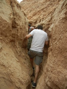
At one point, we ventured the wrong way. The people I was following ended up in a rock-enclosed dead end. Retracing our steps, led us back to the rugged trail.
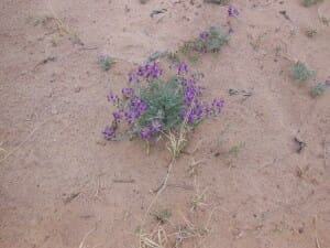
In spite of the arid and foreboding climate, vegetation and wildlife survives. We did not see any animals since most are nocturnal. I am personally glad that we avoided seeing the scorpions, midget faded rattlers or coyotes that live within the park’s perimeter. However I did stop to gaze at various types of wildflowers and shrubs.
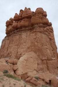
As we continued to fight the stiff wind and onslaught of sand, we chuckled as our imaginations wandered. Was millions of years of geological history playing tricks with us? Didn’t these structures have facial features? Could they be mistaken for goblins?
If you are anywhere near this area, I recommend a visit. This state park is a hidden treasure within driving distance of more famous national parks.
Related Blogs:
Colorado National Monument- Near the Colorado & Utah Border (Guest Blogger at Mom it Forward)
Have You Considered a Family Retreat?
Family Vacations: Why to Cruise With Celebrity Cruises (Guest Blogger at Mom it Forward)
Sandra’s Bio
Leave a Reply
You must be logged in to post a comment.