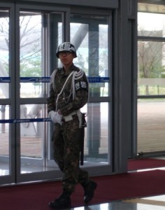
Historical sites are at the top of my list of places to tour. When visiting Seoul, South Korea, I took a memorable journey north to the Korean Demilitarized Zone for a DMZ tour. I wanted to see first-hand the barrier area that separated North Korea from South Korea.
Since we would be touring the restricted area for several hours, an early lunch at Koree: Korean Fusion Dining was first on our agenda.
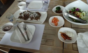
Once again, I was treated to an authentic Korean lunch that included multiple courses. By the third day in South Korea, I was truly enjoying kimchee. After finishing lunch, we were on our way to the DMZ.
At the conclusion of the Korean War (1950-1953), Korea was divided into South and North Korea. Separating the two countries is the DMZ, running along the 38th parallel north. This area serves as a buffer zone that measures two kilometers on each side of the line.
North Korea, China, and the United States representing the UN Command signed an armistice on July 27, 1953. Originally, the parties thought that a peace treaty would be signed within a few months. Over sixty years later, the Koreans are still waiting to be reunited.
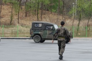
Access to the DMZ is strictly regulated. Only certain groups are allowed entrance. Before entering this restricted area, everyone on our bus had to show a passport to the military person who walked down the aisle of the bus. Photos were not allowed while the soldier was inside and during various portions of our trip.
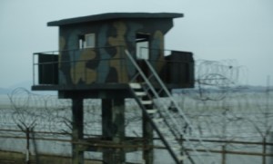
As the bus traveled toward the Nuri Peace Park, we viewed lush vegetation and a preponderance of birds. Towering barbed wired fences with warning signs for mines reminded visitors of this area’s wartime past. Since no one has been able to enter the cordoned off areas for more than 60 years, this natural ecosystem has remained untouched.
Imjingak (Nuri Peace Park)
This park was established in 1972, after the declaration of the joint South-North statement. Imjingak houses relics and monuments from the Korean War and subsequent South-North confrontations. It is located on the southern bank of the Imjingang River.
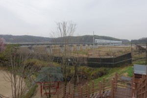
Near the entrance, we could see an abandoned bridge off to the lefthand side. This foot bridge was used as an access point for prisoners of war to return home.
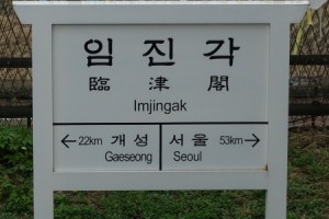
A simple sign reminded visitors of the distance between Gaeseong and Seoul. A quick Google search reveals a different spelling for Gaeseong as well as this tidbit of information.The Korean Armistice Agreement called for North Korean control over Kaesong. It was the only city to change control from South to North.
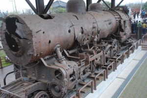
A rusted old train stood as a reminder to earlier times.
Manghaedan at Nuri Peace Park
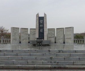
This stone altar symbolizes the fears and the hopes of the people in the north who fled to the south at the end of WWII. The war put an end to Thirty-six years of Japanese colonial rule. As a result, Korea was arbitrarily divided between north and south. Millions of people fled the North to avoid the terror perpetrated by the North Korean Communist Party and the Soviet Army. Every Korean Thanksgiving Day, these refugees built a temporary altar at Imjingak to honor their relatives who they left behind in North Korea. The Korean government built this permanent altar, Mangbaedan, for these people.
The Peace Bell at Nuri Peace Park
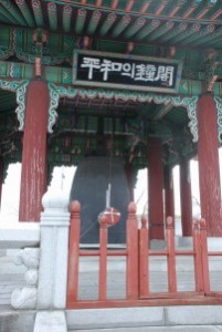
The Peace Bell was dedicated on January 1, 2000 to welcome a time of reunification and peace. With the erection of the bell, the local government hoped that one day all of the citizens of Korea could come together.The bell is 2.23 meters in depth and 3.8 meters high and weighs 21 tons. It is fashioned in a traditional Korean style using bronze and tin.
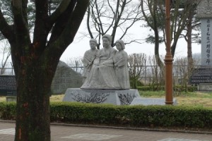
There were numerous statues. All of the signs were in Korean.
Road to Third Tunnel
After boarding the bus, we were told that there would be a point when we could not use our cameras. Our guide sternly stated that there would be serious consequences if people chose not to follow the rules.
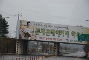
At one point we turned the corner. A large bridge with and enormous sign was off to the right side. Our guide told us that in the event of an attack from the North, the concrete would tumble and block this major roadway.
During this drive, mayhem occurred in the front of the bus. Apparently, someone was taking pictures out the windows and the surrounding passengers became irate. Most of the people preferred to enjoy the tour rather than being detained by the border police.
Third Tunnel
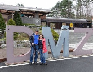
The 3rd Tunnel was discovered in 1978 by the South Korean military. Kim Bu-Seong, a North Korean defector, told the South Koreans about the existence of the third tunnel. After learning this news, it took the South Koreans several years to locate it.
After the discovery of the tunnel, the North Koreans claimed that it was made by the South Koreans to invade North Korea. However, evidence shows that the residue from the explosions used to make the tunnel face southward- in the other direction.
At least 3 other tunnels were discovered with untold others yet to be found. To date, the Third Tunnel is the largest one that has been found.
We were allowed pictures outside the tunnel building, but were not able to bring any cameras inside. We took a train down 73 meter and then disembarked. We were provide hardhats since taller people needed to crouch down in order to walk through the dimly lit and damp tunnel. Along the way, our guide pointed out coal residue on the rock surfaces. Even though coal is not indigenous to this area, the excavators left coal on the wall surfaces so that it looked like an abandoned coal mine.
We walked for a little more than 265 meters before we had to turn around and head back to the train. At this end point, we encountered a concrete barrier that divides the South from the North.
I may not have any pictures of this site, but I am left with amazing memories of the current state of the DMZ.
Dora Observatory
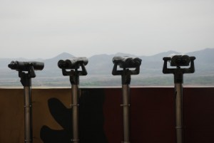
Cameras were allowed up to a certain point where the pavement was marked with a distinct line. After you crossed over the line, you could not use a camera. You could look or use the stationary binoculars to see past the DMZ into North Korean. A sign overhead labeled points of interest.
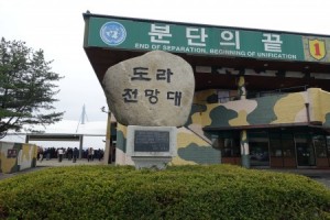
Near the parking lot, there was a large building with a UN sign that read- “End of Separation, Beginning of Unification.”
Dorasan Station: Starting Point of the Transcontinental Railroad
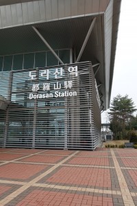
It is located approximately 56 km from Seoul and 205 km from Pyeongyang.
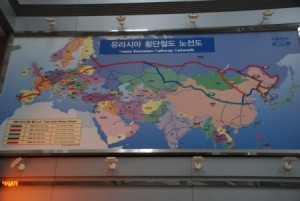
If the train service between North and South is ever established, Dorasan Station will also play the role of customs and immigration for visitors entering South Korea. The above map illustrates the Trans Eurasian Railway Network.
President Bush visited the station on February 20, 2002. During his visit, he optimistically stated-
My vision is clear: I see a Peninsula that is one day united in commerce and cooperation, instead of divided by barbed wire and fear. Korean grandparents should be free to spend their final years with those they love. Korean children should never starve while a massive army is fed. No nation should be a prison for its own people.
Reflecting on Visit
While the South Koreans look toward to the “End of Separation and the Beginning of Unification,” the North Korean government takes an opposite stance. It appears unlikely that the North Korean government will change its mindset anytime soon. In the meantime, families will remain separated, the people in North Korean will live under the tight reigns of a oppressive government, and the South Korean military will need to be vigilant on its borders.
As I walked through the Third Tunnel, I couldn’t help but recall the tunnels that were destroyed during Operation Protective Edge (July-August 2014 ) on the Israeli border. The Third Tunnel is clearly an earlier version of what is being built by Hamas terrorists today. These clandestine structures are a significant threat to any peaceful nation that does not want a hostile group entering its country by surprise. Early detection is essential and constant monitoring is crucial.
Related Posts
Pre Cruise Exploration- Hong Kong
Foodies Paradise- London’s Borough Market
A Taste of Israel- Machane Yehuda Market
Sandra’s Bio
Sandra Bornstein is the author of MAY THIS BE THE BEST YEAR OF YOUR LIFE. It is available on Amazon. Sandra’s memoir highlights her living and teaching adventure in Bangalore, India. She is a licensed Colorado teacher who has taught K-12 students in the United States and abroad as well as college level courses. Sandra is married and has four adult sons. The memoir was a finalist in the Travel category for the 2013 Next Generation Indie Book Awards, the 2013 International Book Awards, the 2013 National Indie Book Excellence Awards, the 2013 USA Best Book Awards, and received an Honorable Mention award in the Multicultural Non-Fiction category for the 2013 Global ebook Awards.
Leave a Reply
You must be logged in to post a comment.